
Drone modeling and measurements for land, sites, and stockpiles.
Orthomosaic maps, 3D models, and measurement reports from a single flight. Stockpile volumes and site areas in days, not weeks.
Photogrammetry turns a structured drone flight into measurable data. The drone flies a grid over the site and captures hundreds of overlapping photos, and processing software stitches them into an orthomosaic, a single top down map image where everything is in its true position, plus a 3D model of the terrain and structures. From there you can pull practical numbers: the approximate area of a lot, the footprint of a building, the approximate volume of a stockpile.
Deliverables
- Orthomosaic maps, a true to position aerial map of the full site.
- 3D models of terrain and structures for visualization and review.
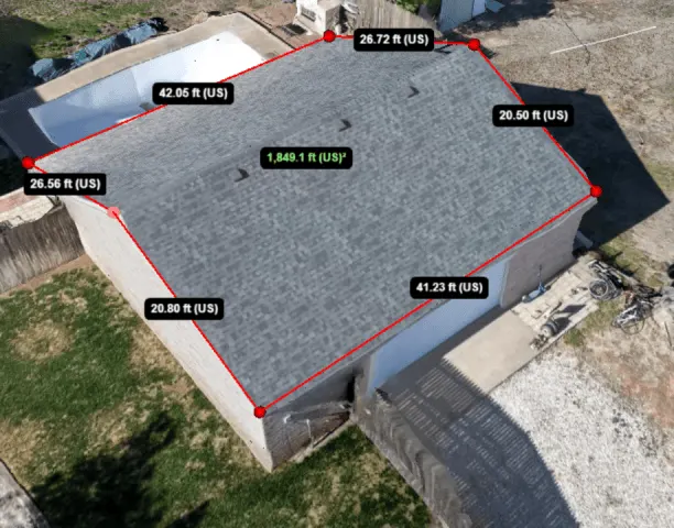
- Area approximations for lots and surfaces.
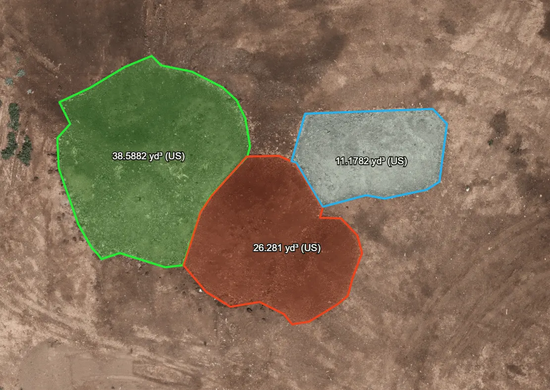
- Volume approximations for stockpiles and earthwork.
- Site documentation sets that pair with construction progress flights.
Where the numbers help
Land listings get real context: the property and its surroundings in one current, true to position map image. Construction sites get dated documentation they can measure against. Operations that move material get stockpile volume approximations without sending anyone up the pile. These are photogrammetric approximations for planning and documentation, not a licensed land survey, and we state that line clearly on every project.
Get a quote
Modeling projects are quoted by site size and deliverables. Send the form below with the location and what you need measured, or call or text (806) 683-4875, and we will scope it. Delivery runs 24 to 48 hours for most sites.